A publication of the Cedar
Mill Business Association
 |
Previous Issues |
| Cedar Mill Community Website |
|
| About Cedar Mill News |
February
2005
A publication of the Cedar
Mill Business Association |
||||||
|
||||||
| Volume 3, Issue 2 | February
2005
|
|||||
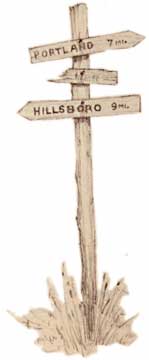
Elk trails and Wapato paths
One Indian path started in Oilton, south of St. Johns, and passed through Bonny Slope, at the north end of Cedar Mill. H. Ross Findley’s diary recorded… It was probably made by the ancient Wapatoes, Tualatins and the Sauvie Indians [with] foot prints and horses as they traveled back and forth from the fishing grounds along the Columbia and Willamette rivers to the wapato swamps and camas beds in the Tualatin Valley. It was no doubt their main route of travel until the forest and undergrowth blocked their trail and they had to choose a shorter route which chanced to be the Springville Trail… It is quite likely that Springville Road began as an Indian trail,
as the Wapato chief Caseno had a residence at the location of modern Springville
just downstream from the St Johns Bridge. On the Surveyor General’s
township sketch of 1855, the track is mapped as the “Road from the Plains
to Bakers.” Baker, a Springville business man, and perhaps others with
economic interests, improved the Indian trail until it could accommodate
grain wagons from the Tualatin Valley. The users of this steep road, to spare
the heels of their horses and oxen, had to drag fresh-cut well limbed trees
at the wagon tail to slow it down. Even today, the steep part of Springville
Road is in primitive condition, little changed from the 1850s. The Old Mountain Road, or the Plains-Portland Road, was the route having the most impact on Cedar Mill. The road passed directly through the community from NW 143rd, intersecting Cornell Road near the current location of Sunset High School and continuing to the present Barnes-Cornell junction. Running in a southeasterly direction, the Old Mountain Road conformed with modern Barnes Road for less than a mile , then branched off on a route that in most places was some 800 feet north of present-day Barnes Road. Near the summit of the Tualatin Mountains, it descended to Sylvan and proceeded to Portland by Tanner Creek Canyon, now known as Canyon Road. West Union Road joined the Old Mountain Road near the Union Schoolhouse and Cemetery site and that is probably why the school and cemetery were established there. While the west end of the road through Bethany and West Union was established earlier, the Cedar Mill link, now called NW 143rd, was developed some time later. The Schoolhouse is gone but the Cemetery remains. Roads, like everything else, have a past, a present and no doubt, a future, ever changing to accommodate those who use them. Next time you are stuck in construction traffic or become confused due to the demise of familiar route landmarks, think of the deer and elk from long ago who started those routes. NEWS HOME |
Sign Up Now to
receive |
The Cedar Mill News Cedar Mill Business Association Publisher/Editor:Virginia Bruce |
 Many early transportation routes in the
Tualatin Valley began as Indian trails routed around geographic obstructions.
And the Indian trails probably began as natural animal paths. Later,
several of these routes were improved by the pioneers after they
established themselves here. In those early days it was a vast wilderness
with Cedar Mill just being a part of the whole.
Many early transportation routes in the
Tualatin Valley began as Indian trails routed around geographic obstructions.
And the Indian trails probably began as natural animal paths. Later,
several of these routes were improved by the pioneers after they
established themselves here. In those early days it was a vast wilderness
with Cedar Mill just being a part of the whole.