

January storm hits hard in Cedar Mill
By Virginia Bruce
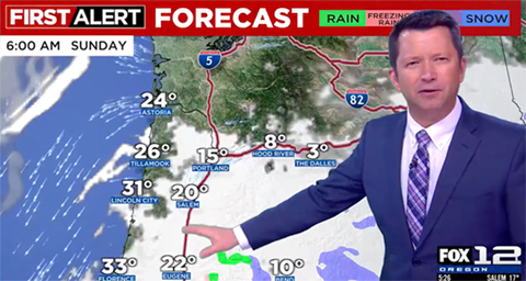
Forecasts were calling for colder temperatures and the possibility of snow from January 10, 2024. The month had started off with mild temperatures and rain. As the weekend approached, some were skeptical. We’ve been fooled before with the promise of snow. But by Saturday, January 13, temperatures had fallen into the 20s and winds had picked up. Moist air from the coast met freezing arctic air right over Portland. It often seemed to be snowing sideways, and it piled up in drifts against fences and buildings.
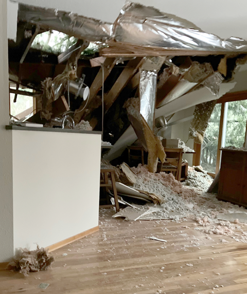
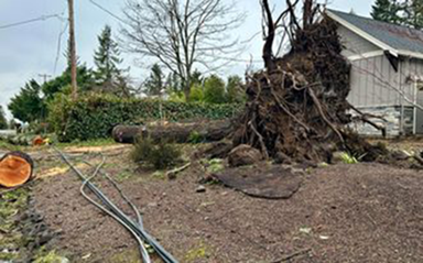
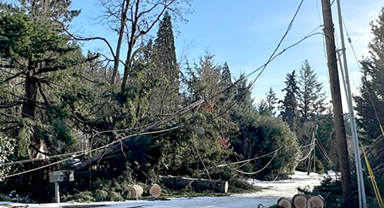
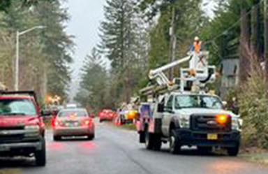
High winds were peaking on the 15th with low temperatures in the 20s, and trees were falling all over the area, causing power outages. As people struggled to stay warm, plumbing pipes were freezing and bursting.
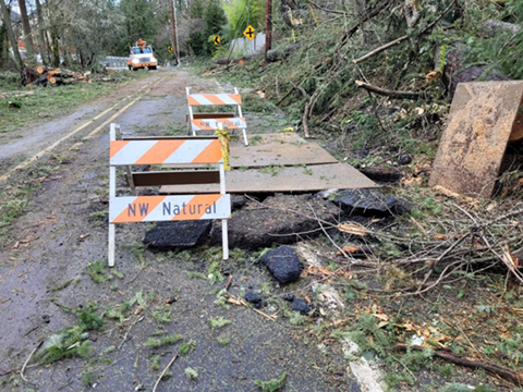
A couple of the hardest hit areas in the Metro region were in and around Cedar Mill. The neighborhood around NW Taylor looked like a war zone. Several homes north of Laidlaw in the Bethany area suffered severe damage from falling trees. Laidlaw Road closed because of fallen trees, damaged utilities, and damage to the road surface, and only opened to one lane of traffic on February 2.
I wondered if the strong freezing east winds from the gorge were whipping over the West Hills. KPTV Chief Meteorologist Mark Nelsen agreed. “Correct! Eastern wind from the Gorge DOES go up and over the West Hills, then comes down the west slopes of those hills. Then that wind spreads out and slows down as it drops lower in the Tualatin Valley. This is a common occurrence, but wind was extra strong this time.”
Nelsen shared more of his experience in response to our questions.

Did you have to put in longer hours during the storm?

Yes, during these big storm/weather events I’m pretty much “on” as soon as I wake up in the morning (around 9am) until 11:32pm when the last newscast ends. I immediately start checking out weather maps/models over my morning coffee, then by 11 am I’m writing a detailed blog post, making a forecast, then driving to work about 1pm. I live way out just east of Corbett in the Columbia River Gorge so it takes me about 40 minutes to get to work on a normal day.
Did any of the team have to spend the night at the studio? I know that some NWS-Portland people did!
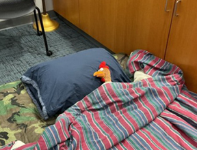
During severe weather, the TV station puts up quite a few people in one or two of the five hotels we have nearby in the business park. It would be extremely rare for someone to spend the night here since it’s almost walking distance to the hotels. I have seen hotel rooms run out during a previous storm and a couple people slept on two different couches in the station.
I think I remember that you stayed on the air outside your regular live News broadcast times at some point, is that right?
In the past we’d do “continuous coverage” (extra on-air newscasts) during these events. But we have so many afternoon/evening newscasts nowadays that we don’t produce much more content than normal. Just by chance this time the early-afternoon periods were quiet too. So, except for that first Saturday afternoon storm day (the really cold/windy one), I didn’t work extra on-air.
When the storms were first forecast, did anyone think they’d be so bad?
In the two or three days ahead of that Saturday wind/cold storm, I said several times on-air that I had never seen such an extreme combo of wind plus cold. That is true, we’ve seen much higher and damaging wind, and colder temperatures, but not the combination in my 32 years forecasting in the metro area.
Did the studio ever lose power? Or do you have backup power? Any damage to the facility?
We did not lose power, but on the cold/windy Saturday we DID lose heat for about three hours. Temperature dropped to 55 in news studio, but then it started working again…whew! It was getting cold quickly… No damage here.
How do you collaborate with the National Weather Service (NWS)? Just online updates or with phone/other communications?
We have a Slack message ability with NWS where we can exchange messages. We like to make sure their message gets out to the public!
For folks that are not aware, I’ve been publishing a weather blog for almost 20 years! When the weather gets wild (mainly winter weather events), I can give you far more detail there than on TV. During the warm season I don’t post much because our weather is so tranquil much of the time. But when winter weather threatens, make sure you are reading those blog posts! I am not aware of any other detailed weather blog from a television meteorologist in the Pacific Northwest.
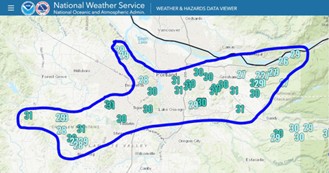
David Bishop, a meteorologist with NWS Portland, pointed out that wind on top of more ice caused much of the really severe storm damage with two significant weather events back-to-back, high winds and snow on January 13-14, and then more wind and freezing rain from the 17-19th. Wind speeds on January 19 reached 45 mph.
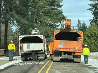
Washington County declared a weather emergency on January 16, allowing access to state and federal funding to offset storm response. Snow zones were activated on Barnes and Cornell. Many local streets closed because of downed power lines and trees. They issued a Storm Recovery Update with links to helpful information. You can read it online here. The Road Maintenance web page currently includes a section on 2024 Storm Recovery with links for helping you deal with storm damage.
Portland General Electric supplemented their repair crews with teams from other states to respond to power outages, as trees brought down power lines which then caused transformers to blow. They prioritized distribution lines serving more customers, so some folks “at the end of the line” had to wait longer for service to be restored. We wrote about how the system worked in this article.
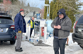
Many lost cable tv and internet, and for some, service wasn’t restored for more than a week. Comcast noted that they had to wait both for trees to be removed and for power lines to be repaired before they could access their wires. At times, cellular service provided many of us with our only connection to information.
In January 2018 I created the “Cedar Mill News Group” as a place for neighbors to share information on Facebook. We gained at least 1000 members during the storm, as folks told their neighbors. It became a hub for sharing road conditions, power outages, and vital information such as how to light a gas fireplace without power. Many were disappointed with the information provided by the utility companies, so information sharing within the group was helpful with that. Once people began to recover, they shared tips and plans for “the next time.” One of the group members compiled recommendations for contractors to help with recovery into a file available to download.


