

It falls over lava! The geology of Cedar Mill Falls
By Virginia Bruce
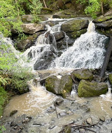
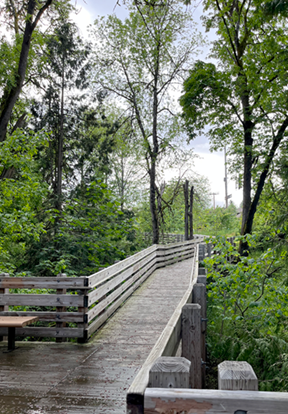
Cedar Mill Falls is the only waterfall in eastern Washington County, and one of the only urban-area falls in Oregon. At 32 feet high, it’s certainly not as impressive as the 580-foot Ki-A-Kuts Falls near the headwaters of the Tualatin River, but it’s charming and accessible. The Sue Conger Boardwalk was built as part of the Timberland development and the trail and the falls belong to Tualatin Hills Park and Recreation District.
We wondered about how the falls was formed. An earthquake-caused fault? Nope, says Scott Burns, Professor Emeritus of Engineering Geology, Portland State University, and our go-to guy for the geologic history of our community.
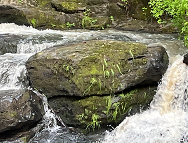
“The falls are one flow of basalt from the volcano up the slope. The falls go over the end of that flow which is the Elk Point Flow of the Boring Lavas. [This flow] rests on the Boring lava that is below from an earlier eruption of that volcano up the slope which is the Bonny Slope Flow of the Boring Lavas.” Burns referred me to Anne MacDonald, a geologist with Clean Water Services, who provided a link to the map referenced below.
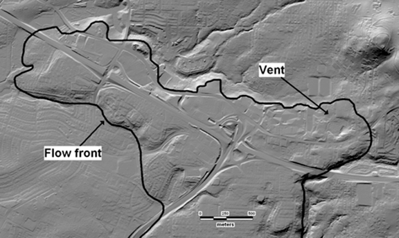
Volcanoes in Cedar Mill? Yes, according to the 2008 Linnton Quadrangle Map*, “The vent for the [Elk Point] flow is inferred to be a roughly circular depression 200 m in diameter and 7 m deep that is located just north of Barnes Road and just east of Catlin Gabel High School (Figure 5) and occurs at the highest and easternmost part of the flows.” So the lava flowed out of the vent, and stopped flowing as it cooled and congealed.
And another volcano in Bonny Slope? “The vent for the flow is inferred to be a crudely conical hill, just west of Bonny Slope, and occurs at the highest and easternmost part of the extent of the flows.”

Developers can attest to these basalt flows. Excavation for my subdivision required extensive cracking of the rock layer that was lurking below shallow soil. The resulting chunks of basalt were spread through our topsoil like raisins in oatmeal!
*Preliminary Geologic Map of the Linnton 7.5’ Quadrangle, Multnomah and Washington Counties, Oregon, a publication of the Oregon Department of Geology and Mineral Industries (DOGAMI), 2008
“This map was prepared as part of a multi-year collaborative effort between the U.S. Geological Survey (USGS) and the Oregon Department of Geology and Mineral Industries (DOGAMI) to improve geologic mapping in the Portland urban area in order to better understand earthquake hazards. …In addition, detailed geologic mapping provides information about the extensive landslide hazards in the area.” You can download the report here.


